Welcome to Madeira Island, a small Portuguese archipelago and a tropical paradise situated in the center of the Atlantic Ocean. Despite its small size it offers a plethora of palm trees, pines, eucalyptus, laurel forests, volcanic mountains, rocky beaches and a photo season all year round. Needless to say that no matter where you are on the island, you will always be able to find a great photography spot.
During the autumn of 2021, I was lucky enough to stay here for a week, exploring some interesting sites, enjoying some well-earned vacation and extend my landscape portfolio.
Getting Around
On Madeira, you should rent a car to be flexible. Choose for a smaller vehicle to be able to navigate the often narrow roads. But make sure it has enough horsepower to get up the steep mountain roads. What you'll not need on Madeira is an off-road capable car. The road system is well maintained with various major roads that connect the different parts of the island. The mountain roads are smaller and can in parts be a bit bumpy, but nothing to be worried about.
Throughout the island, you'll find many viewpoints and hiking trails with adjacent car parks, which makes it easy to find a place to park your car when you're heading to a photo spot.
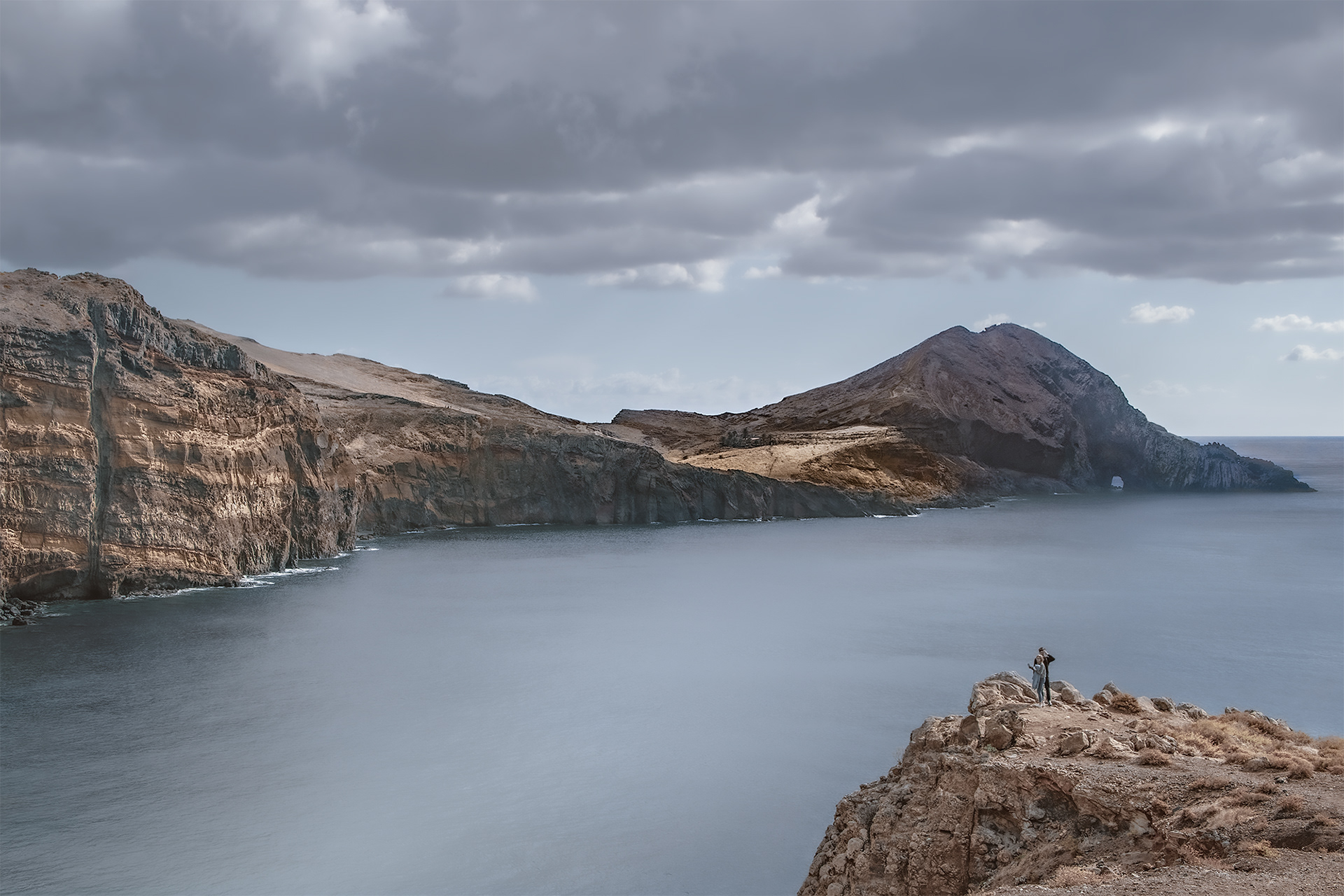
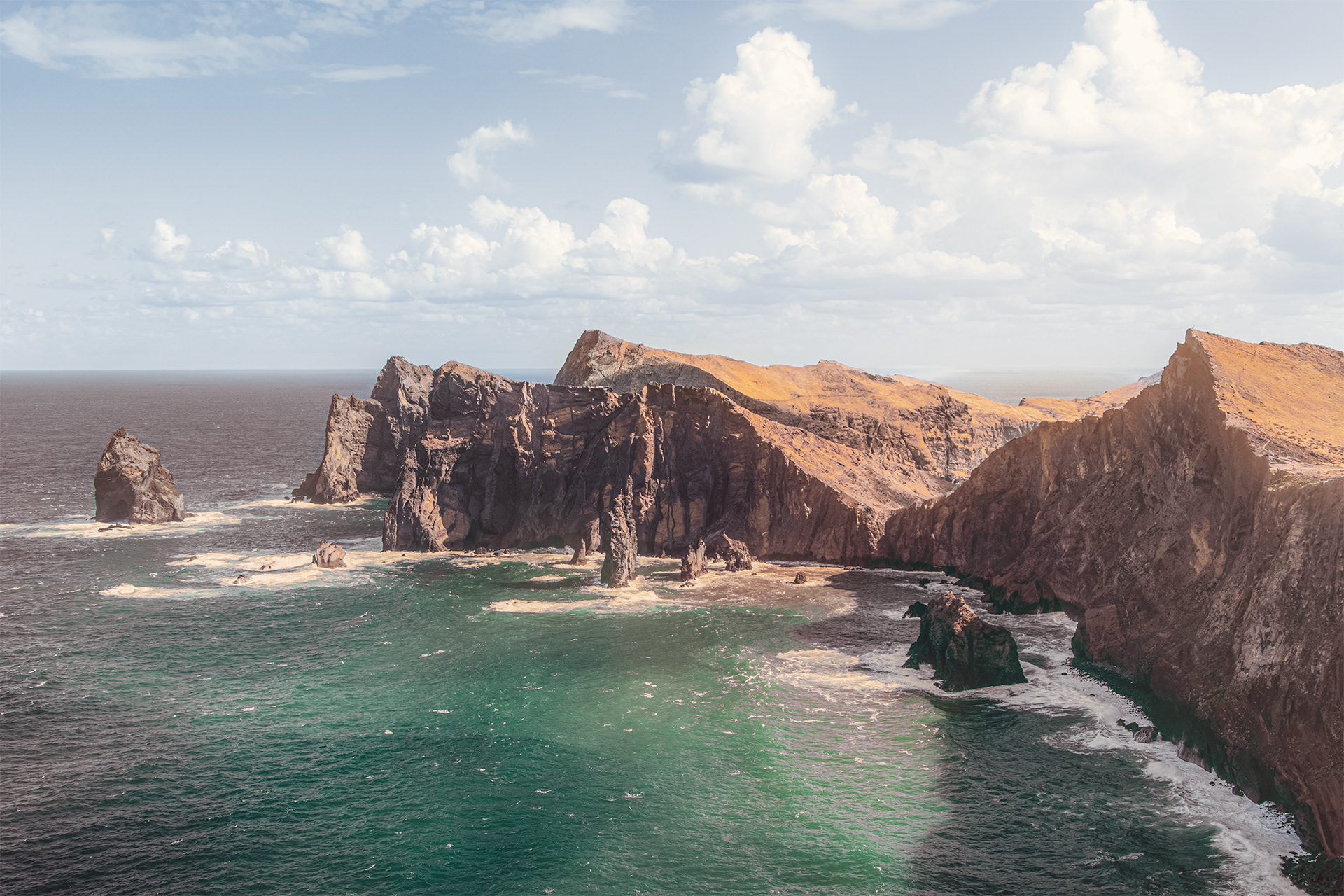
Ponta de São Lourenço, volcanic wonder of Madeira
If you love dramatic seascapes, you'll love Madeira. And if you want to photograph the arguably best coastal views on the island, you have to visit Ponta de São Lourenço, a peninsula located in the far east of the island.
Ponta de São Lourenço feels more of tundra than of tropics. It is a rough and windy place with impressive cliffs where you can really admire the volcanic nature of the island. During autumn or winter winter, you can get cold and wet easily if you don’t take a rain jacket. However, the more complicated photo conditions, the more interesting the result.
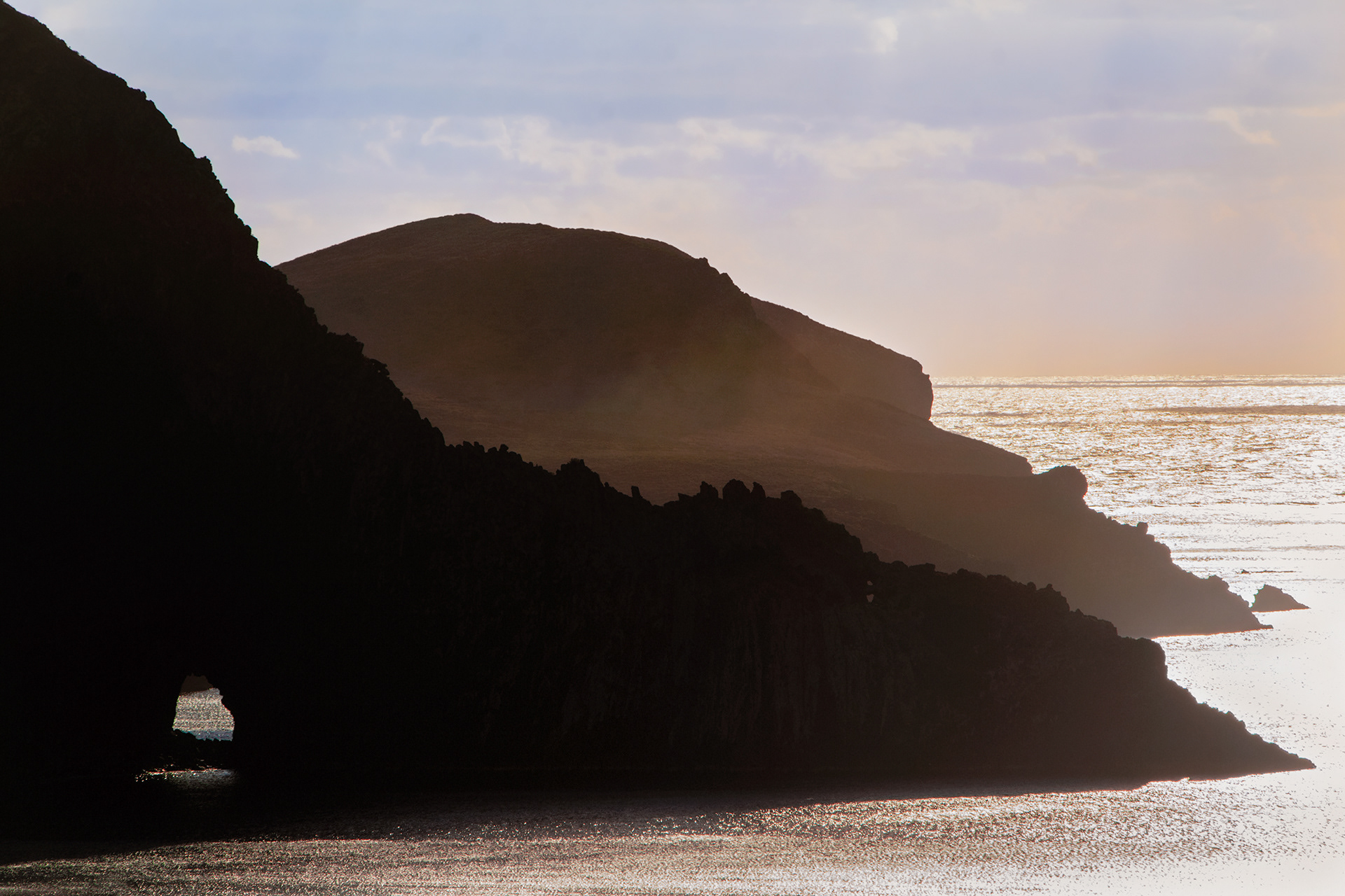
Ponta do Rosto, the sunrise spot
Another beautiful sunrise viewpoint is Ponta do Rosto. The impressive views on the cliffs of São Lourenço create a fantastic sunrise viewpoint overlooking the ocean and volcanic cliffs.
It is one of the most easy to reach photo spot locations in Madeira. The location is well marked on Google Maps, so no challenging navigation here. You can drive all the way up to the viewpoint, park your car and start shooting.
Once arrived at Ponta do Rosto you can see the viewpoint directly in front of the car park. This is the most famous spot, however there are more viewpoints in this area if you go further down the coast to the left, away from the trail. Miradouro da Luna is one of them which you can find on Google Maps.
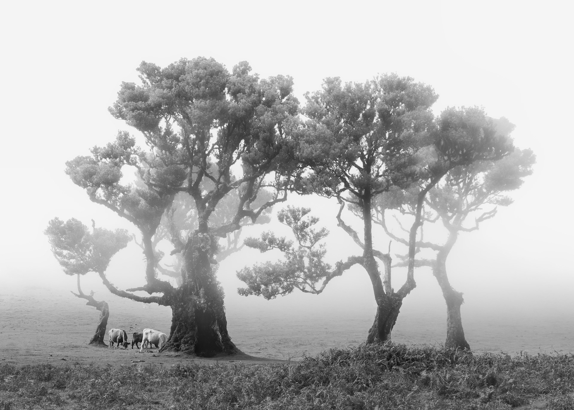
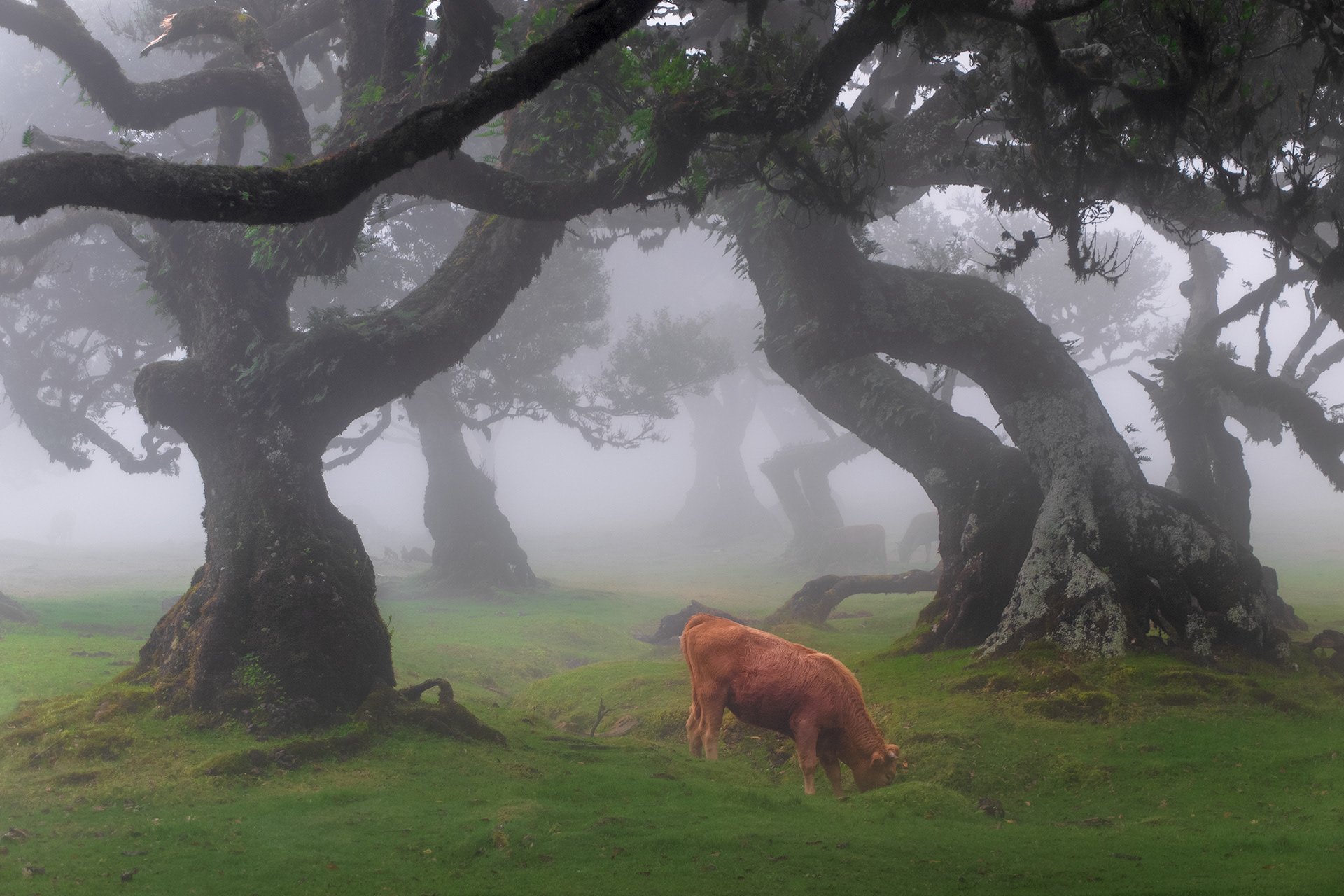
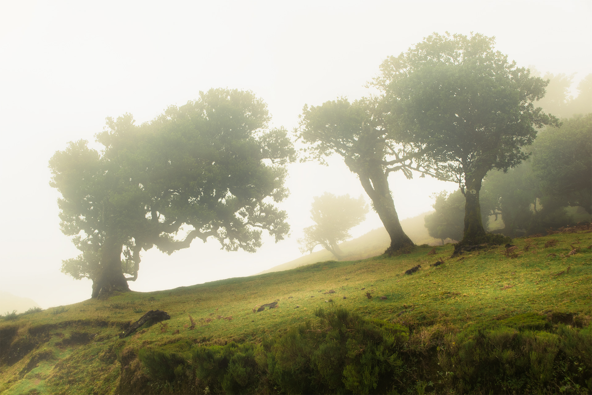
Fanal, the magical forest
During the week I had in Madeira, one of my main photographic focuses was the Fanal forest, located on a high plateau in the north-western part of the island.
Often, unfortunately not always, the forest is completely covered in a mysterious fog, creating scenes straight out of a fairy tale. At those moments, the whole area turns into a photographer’s dream. The twisted tree branches, covered with layers of moss, have such interesting shapes that is almost looks as if they are alive. And soon you are overwhelmed by the idea you can catch an elf or a hobbit behind every tree. During the moments I visited Fanal the elves and hobbits had been replaced by cows, which is second best, I guess.
Whether you are a tourist, amateur photographer, or professional photographer, you surely must experience Fanal Forest with fog at least once! The spot is quite easy to find as it has a dedicated parking lot called ‘Fanal Parking' on Google Maps. Here you can park your car and walk straight into the forest or visit one of the nearby viewpoints.
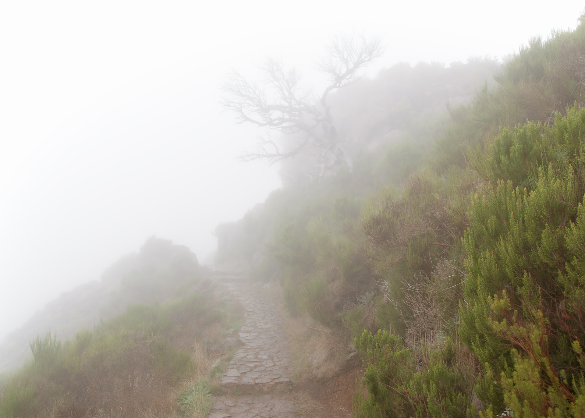
Pico Ruivo, summit of dead trees
Pico Ruivo is the highest point on Madeira, standing at 1,862 meters above sea level. The summit is accessible by foot; there are two challenging hiking trails which climb trough the stunning mountainous scenery of Madeira's interior.
I took the shorter trail. starting at the car park of Achada do Teixeira, and climbing eastwards to the top. This route has a total length of 5.6 km (2.8 km each way) and takes about 2 hours. This is the more popular route that also is taken by tourist tours to reach the summit (and watch the sunrise).

The longer route connects the Pico de Arieiro to Pico Ruivo. This is the more challenging trail, passing through tunnels, crossing ridges and is about 15 km to complete. Due to time constraints I could not walk this route (sometimes one has to make difficult choices), but it is said the dramatic scenery makes it worthwhile.
The weather on Pico Ruivo is unpredictable and rapidly changes. When visiting, always be well prepared (shoes - rain jacket - food) and check weather conditions before setting out. During the time I was here, almost the entire trail was covered in a thick layer of fog. So no amazing mountain views for me, but the combination of the fog with the dead trees you find all along the trail creates an incredible atmosphere.
Many great landscape photographer like Nigel Danson and Daniel Kordan have captured these trees in a beautiful and fine art way before. I tried my best as well 😉.